How to Read a Farmland Sale Record

The Land Sleuth
Every farmland sale record contains a sale code, PLSS location, deed type, acreage, CSR2 score, and price per acre. This guide explains what each field means and how appraisers, lenders, investors, and landowners use it to analyze Iowa and Illinois farmland markets.
How to Read a Farmland Sale Record
By Greg Conrad — The Land Sleuth | LandSleuth.com
Every farmland sale recorded in an Iowa or Illinois county courthouse contains a surprising amount of information — if you know how to read it. A sale record is not just a price and a date. It encodes the location of the parcel in the Public Land Survey System, the type of deed used to convey title, the size of the tract, the soil productivity score, and the calculated price per acre and per CSR2 point. Together, these data points form the building blocks of a credible comparable sales analysis.
This guide walks through each field in a LandSleuth sale record, explains what it means, and shows how appraisers, lenders, investors, and landowners use it in practice.
The Sale Code: A Unique Identifier for Every Transaction
Every record in the LandSleuth database carries a sale code in the format:
YYYY-FF-SS-NNN
Breaking that down:
| Segment | Meaning | Example |
|---|---|---|
YYYY | Year the deed was recorded | 2025 |
FF | FIPS county code (Iowa uses 2-digit; Illinois uses 3-digit) | 37 (Greene County, Iowa) |
SS | Sequential sale number within that county and year | 04 |
NNN | Sub-record number within a multi-parcel transaction | 001 |
So a code of 2025-37-04-001 means: the first parcel in the fourth recorded farmland sale in Greene County, Iowa, in 2025. When a single deed conveys multiple non-contiguous parcels, each parcel gets its own sub-record (001, 002, 003, etc.) so that acreage, location, and soil data can be tracked at the parcel level rather than the transaction level.
This structure makes it straightforward to trace any record back to its source deed in the county recorder's office.
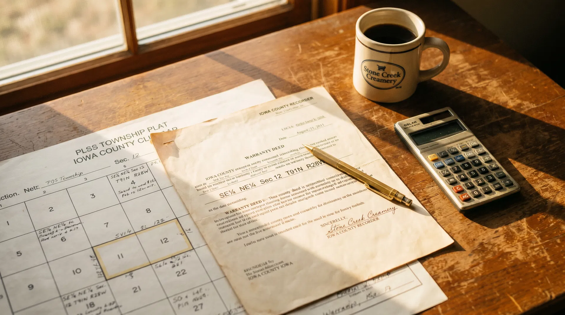
Location: Reading the PLSS Description
Iowa and Illinois farmland is located using the Public Land Survey System (PLSS), the rectangular grid established by the federal government in the late 18th century. Every parcel in the LandSleuth database carries a PLSS location string in the form:
Section-Township-Range
For example: S14-T80N-R30W means Section 14, Township 80 North, Range 30 West.
| Component | What It Describes |
|---|---|
| Section | A one-square-mile block (640 acres) within a township. Numbered 1–36. |
| Township | A six-mile-square block of 36 sections. Numbered north or south from a baseline. |
| Range | A six-mile-wide column of townships. Numbered east or west from a principal meridian. |
Most farmland sales involve a fraction of a section — a quarter-section (160 acres), a half-section (320 acres), or an irregular parcel described by metes and bounds. The PLSS location in the database identifies which section the parcel falls within, allowing users to cross-reference against county plat maps, FSA records, and aerial imagery.
For Illinois records in the LandSleuth database, PLSS strings marked (approx) were derived from township centroid geocoding where the original deed did not include a section-level description. These are accurate to the civil township level but should be verified against the source deed for precise section identification.
Deed Type: What Kind of Conveyance Was This?
The deed type tells you something important about the nature of the transaction and the quality of the title being conveyed. LandSleuth records the deed type as reported in the county deed index. Common types include:
| Deed Type | Description | Implication for Comparability |
|---|---|---|
| Warranty Deed | Seller guarantees clear title and will defend against future claims. | Strongest form of conveyance; highest comparability weight. |
| Executor's Deed | Conveyed by the executor of an estate to a buyer. | Generally arm's-length; good comparable. |
| Trustee's Deed | Conveyed by a trustee on behalf of a trust. | Often arm's-length; review for related-party flags. |
| Quit Claim Deed | Conveys only whatever interest the grantor holds, with no title warranty. | May indicate a non-arm's-length transfer; use with caution. |
| Sheriff's Deed | Conveyed through a court-ordered sale (foreclosure). | Distressed sale; typically excluded from market value analysis. |
For most market analysis purposes, warranty deeds and executor's deeds carry the most weight as evidence of arm's-length market value. Quit claim deeds between family members or related entities are typically excluded from comparable sales analyses.
Acres: Gross vs. Tillable
A farmland sale record will typically report both a gross acreage and a tillable acreage figure. Understanding the difference is essential for interpreting price-per-acre figures correctly.
Gross acres is the total legal area of the parcel as described in the deed — including roads, waterways, timber, farmstead sites, and any other non-cropland features.
Tillable acres (also called cropland acres) is the portion of the parcel that can be actively farmed. This is the figure that drives cash rent income and is most directly tied to the CSR2 score.
When comparing sales, always confirm which acreage figure is being used in the price-per-acre calculation. A parcel with 160 gross acres but only 120 tillable acres will show a very different price-per-tillable-acre than a clean 160-acre tract with no waterways or timber. LandSleuth records both figures where available, and the $/acre calculation in each record specifies which basis is being used.
Price Per Acre: The Primary Market Indicator
The price per acre is the most widely used metric for comparing farmland sales. It is calculated simply:
Price Per Acre = Total Sale Price ÷ Acres
When comparing sales across a county or region, price per acre allows you to normalize for parcel size. A 40-acre tract and a 320-acre tract can be compared on the same basis. However, price per acre alone does not account for differences in soil quality — which is where the CSR2-adjusted figure becomes essential.
CSR2 Score: The Soil Quality Anchor
The CSR2 score (Corn Suitability Rating 2) is Iowa State University's index of a parcel's inherent agricultural productivity, expressed on a scale of 0 to 100. A score of 87 indicates highly productive ground; a score of 55 indicates significantly lower productivity due to slope, drainage, or soil texture limitations.
For a full explanation of how CSR2 is calculated and why it matters, see: What Is CSR2 and Why Does It Matter for Iowa Farmland Values?
In the context of reading a sale record, the CSR2 score serves two purposes:
1. Explaining price differences between parcels. A parcel with a CSR2 of 85 should command a higher price per acre than a parcel with a CSR2 of 65, all else being equal. The CSR2 score is the primary reason two adjacent farms can sell for $1,000 per acre apart.
2. Enabling the $/CSR2 point metric. By dividing the price per acre by the CSR2 score, you get a normalized figure that allows comparison across parcels with different soil quality:
$/CSR2 Point = Price Per Acre ÷ CSR2 Score
For example, a parcel selling at $12,000/acre with a CSR2 of 80 yields $150/CSR2 point. A parcel selling at $9,000/acre with a CSR2 of 60 also yields $150/CSR2 point — indicating both sold at the same quality-adjusted price level. This metric is the standard tool for building a comparable sales grid in an Iowa farmland appraisal.
Putting It All Together: Reading a Sample Record
Consider the following hypothetical record:
| Field | Value |
|---|---|
| Sale Code | 2025-37-04-001 |
| County | Greene County, Iowa |
| PLSS Location | S14-T80N-R30W |
| Deed Type | Warranty Deed |
| Gross Acres | 160.0 |
| Tillable Acres | 152.4 |
| Sale Price | $1,824,000 |
| Price/Acre (gross) | $11,400 |
| Price/Acre (tillable) | $11,968 |
| CSR2 Score | 76.2 |
| $/CSR2 Point | $149.60 |
| Sale Date | March 2025 |
Reading this record, an appraiser would note: this is a warranty deed conveyance of 160 gross acres in Section 14 of a specific township and range in Greene County. The parcel is 95% tillable (152.4 of 160 acres), with a CSR2 of 76.2 — slightly above the county average. The quality-adjusted price of $149.60/CSR2 point can be compared directly to other Greene County sales regardless of their acreage or soil score, providing a clean basis for a comparable sales analysis.
How to Use the LandSleuth Search Database
The LandSleuth database makes it straightforward to build a comparable sales set for any Iowa county or Illinois county in our coverage area. From the Search page, you can filter by:
- State (Iowa or Illinois)
- County — drill down to any of Iowa's 99 counties or the Illinois counties we cover
- Township — narrow to a specific civil township within a county
- Year range — focus on recent sales or build a longer trend line
- CSR2 range — isolate sales of comparable soil quality
Each record in the results shows the sale code, PLSS location, deed type, acres, sale price, price per acre, CSR2 score, and $/CSR2 point — everything needed to evaluate comparability and build a credible market analysis.
For landowners, investors, and lenders who need to understand what a specific parcel of Iowa farmland is worth, the sale records in this database are the most direct evidence of where the market is pricing ground today.
Related Reading
Understanding how to read a sale record is most useful when combined with a working knowledge of the two metrics that drive Iowa farmland values:
- What Is CSR2 and Why Does It Matter for Iowa Farmland Values? — A deep dive into Iowa's soil productivity index: how it is calculated, what it measures, and why it is the universal language of Iowa farmland quality.
- What Is Cash Rent and How Is It Set for Iowa Farmland? — Cash rent is the income stream that connects a CSR2 score to an investment return. This post explains how rent rates are set and how they relate to land values through capitalization rates.
- Why Farmland May Outperform Residential Real Estate Over the Next 10–15 Years — The structural case for productive agricultural land as a long-term investment, for readers evaluating farmland against other asset classes.
Greg Conrad is a farmland data analyst and the founder of LandSleuth, a courthouse-verified farmland sales database covering Iowa and Illinois. All sale data on LandSleuth is sourced directly from county deed records. He can be reached at [email protected].
Written by
Greg Conrad
The Land Sleuth
Greg Conrad has spent more than a decade sourcing courthouse-verified farmland sales data across Iowa. LandSleuth is built on that same standard of accuracy — every record verified, every price real.
About Greg Conrad →Access the Underlying Data
Search courthouse-verified farmland sales behind every analysis on LandSleuth.
How to Read a Farmland Sale Record
How to Read a Farmland Sale Record
By Greg Conrad — The Land Sleuth | LandSleuth.com
Every farmland sale recorded in an Iowa or Illinois county courthouse contains a surprising amount of information — if you know how to read it. A sale record is not just a price and a date. It encodes the location of the parcel in the Public Land Survey System, the type of deed used to convey title, the size of the tract, the soil productivity score, and the calculated price per acre and per CSR2 point. Together, these data points form the building blocks of a credible comparable sales analysis.
This guide walks through each field in a LandSleuth sale record, explains what it means, and shows how appraisers, lenders, investors, and landowners use it in practice.
The Sale Code: A Unique Identifier for Every Transaction
Every record in the LandSleuth database carries a sale code in the format:
YYYY-FF-SS-NNN
Breaking that down:
| Segment | Meaning | Example |
|---|---|---|
YYYY | Year the deed was recorded | 2025 |
FF | FIPS county code (Iowa uses 2-digit; Illinois uses 3-digit) | 37 (Greene County, Iowa) |
SS | Sequential sale number within that county and year | 04 |
NNN | Sub-record number within a multi-parcel transaction | 001 |
So a code of 2025-37-04-001 means: the first parcel in the fourth recorded farmland sale in Greene County, Iowa, in 2025. When a single deed conveys multiple non-contiguous parcels, each parcel gets its own sub-record (001, 002, 003, etc.) so that acreage, location, and soil data can be tracked at the parcel level rather than the transaction level.
This structure makes it straightforward to trace any record back to its source deed in the county recorder's office.
Location: Reading the PLSS Description
Iowa and Illinois farmland is located using the Public Land Survey System (PLSS), the rectangular grid established by the federal government in the late 18th century. Every parcel in the LandSleuth database carries a PLSS location string in the form:
Section-Township-Range
For example: S14-T80N-R30W means Section 14, Township 80 North, Range 30 West.
| Component | What It Describes |
|---|---|
| Section | A one-square-mile block (640 acres) within a township. Numbered 1–36. |
| Township | A six-mile-square block of 36 sections. Numbered north or south from a baseline. |
| Range | A six-mile-wide column of townships. Numbered east or west from a principal meridian. |
Most farmland sales involve a fraction of a section — a quarter-section (160 acres), a half-section (320 acres), or an irregular parcel described by metes and bounds. The PLSS location in the database identifies which section the parcel falls within, allowing users to cross-reference against county plat maps, FSA records, and aerial imagery.
For Illinois records in the LandSleuth database, PLSS strings marked (approx) were derived from township centroid geocoding where the original deed did not include a section-level description. These are accurate to the civil township level but should be verified against the source deed for precise section identification.
Deed Type: What Kind of Conveyance Was This?
The deed type tells you something important about the nature of the transaction and the quality of the title being conveyed. LandSleuth records the deed type as reported in the county deed index. Common types include:
| Deed Type | Description | Implication for Comparability |
|---|---|---|
| Warranty Deed | Seller guarantees clear title and will defend against future claims. | Strongest form of conveyance; highest comparability weight. |
| Executor's Deed | Conveyed by the executor of an estate to a buyer. | Generally arm's-length; good comparable. |
| Trustee's Deed | Conveyed by a trustee on behalf of a trust. | Often arm's-length; review for related-party flags. |
| Quit Claim Deed | Conveys only whatever interest the grantor holds, with no title warranty. | May indicate a non-arm's-length transfer; use with caution. |
| Sheriff's Deed | Conveyed through a court-ordered sale (foreclosure). | Distressed sale; typically excluded from market value analysis. |
For most market analysis purposes, warranty deeds and executor's deeds carry the most weight as evidence of arm's-length market value. Quit claim deeds between family members or related entities are typically excluded from comparable sales analyses.
Acres: Gross vs. Tillable
A farmland sale record will typically report both a gross acreage and a tillable acreage figure. Understanding the difference is essential for interpreting price-per-acre figures correctly.
Gross acres is the total legal area of the parcel as described in the deed — including roads, waterways, timber, farmstead sites, and any other non-cropland features.
Tillable acres (also called cropland acres) is the portion of the parcel that can be actively farmed. This is the figure that drives cash rent income and is most directly tied to the CSR2 score.
When comparing sales, always confirm which acreage figure is being used in the price-per-acre calculation. A parcel with 160 gross acres but only 120 tillable acres will show a very different price-per-tillable-acre than a clean 160-acre tract with no waterways or timber. LandSleuth records both figures where available, and the $/acre calculation in each record specifies which basis is being used.
Price Per Acre: The Primary Market Indicator
The price per acre is the most widely used metric for comparing farmland sales. It is calculated simply:
Price Per Acre = Total Sale Price ÷ Acres
When comparing sales across a county or region, price per acre allows you to normalize for parcel size. A 40-acre tract and a 320-acre tract can be compared on the same basis. However, price per acre alone does not account for differences in soil quality — which is where the CSR2-adjusted figure becomes essential.
CSR2 Score: The Soil Quality Anchor
The CSR2 score (Corn Suitability Rating 2) is Iowa State University's index of a parcel's inherent agricultural productivity, expressed on a scale of 0 to 100. A score of 87 indicates highly productive ground; a score of 55 indicates significantly lower productivity due to slope, drainage, or soil texture limitations.
For a full explanation of how CSR2 is calculated and why it matters, see: What Is CSR2 and Why Does It Matter for Iowa Farmland Values?
In the context of reading a sale record, the CSR2 score serves two purposes:
1. Explaining price differences between parcels. A parcel with a CSR2 of 85 should command a higher price per acre than a parcel with a CSR2 of 65, all else being equal. The CSR2 score is the primary reason two adjacent farms can sell for $1,000 per acre apart.
2. Enabling the $/CSR2 point metric. By dividing the price per acre by the CSR2 score, you get a normalized figure that allows comparison across parcels with different soil quality:
$/CSR2 Point = Price Per Acre ÷ CSR2 Score
For example, a parcel selling at $12,000/acre with a CSR2 of 80 yields $150/CSR2 point. A parcel selling at $9,000/acre with a CSR2 of 60 also yields $150/CSR2 point — indicating both sold at the same quality-adjusted price level. This metric is the standard tool for building a comparable sales grid in an Iowa farmland appraisal.
Putting It All Together: Reading a Sample Record
Consider the following hypothetical record:
| Field | Value |
|---|---|
| Sale Code | 2025-37-04-001 |
| County | Greene County, Iowa |
| PLSS Location | S14-T80N-R30W |
| Deed Type | Warranty Deed |
| Gross Acres | 160.0 |
| Tillable Acres | 152.4 |
| Sale Price | $1,824,000 |
| Price/Acre (gross) | $11,400 |
| Price/Acre (tillable) | $11,968 |
| CSR2 Score | 76.2 |
| $/CSR2 Point | $149.60 |
| Sale Date | March 2025 |
Reading this record, an appraiser would note: this is a warranty deed conveyance of 160 gross acres in Section 14 of a specific township and range in Greene County. The parcel is 95% tillable (152.4 of 160 acres), with a CSR2 of 76.2 — slightly above the county average. The quality-adjusted price of $149.60/CSR2 point can be compared directly to other Greene County sales regardless of their acreage or soil score, providing a clean basis for a comparable sales analysis.
How to Use the LandSleuth Search Database
The LandSleuth database makes it straightforward to build a comparable sales set for any Iowa county or Illinois county in our coverage area. From the Search page, you can filter by:
- State (Iowa or Illinois)
- County — drill down to any of Iowa's 99 counties or the Illinois counties we cover
- Township — narrow to a specific civil township within a county
- Year range — focus on recent sales or build a longer trend line
- CSR2 range — isolate sales of comparable soil quality
Each record in the results shows the sale code, PLSS location, deed type, acres, sale price, price per acre, CSR2 score, and $/CSR2 point — everything needed to evaluate comparability and build a credible market analysis.
For landowners, investors, and lenders who need to understand what a specific parcel of Iowa farmland is worth, the sale records in this database are the most direct evidence of where the market is pricing ground today.
Related Reading
Understanding how to read a sale record is most useful when combined with a working knowledge of the two metrics that drive Iowa farmland values:
- What Is CSR2 and Why Does It Matter for Iowa Farmland Values? — A deep dive into Iowa's soil productivity index: how it is calculated, what it measures, and why it is the universal language of Iowa farmland quality.
- What Is Cash Rent and How Is It Set for Iowa Farmland? — Cash rent is the income stream that connects a CSR2 score to an investment return. This post explains how rent rates are set and how they relate to land values through capitalization rates.
- Why Farmland May Outperform Residential Real Estate Over the Next 10–15 Years — The structural case for productive agricultural land as a long-term investment, for readers evaluating farmland against other asset classes.
Greg Conrad is a farmland data analyst and the founder of LandSleuth, a courthouse-verified farmland sales database covering Iowa and Illinois. All sale data on LandSleuth is sourced directly from county deed records. He can be reached at [email protected].